Geographical Features
Geographical Features
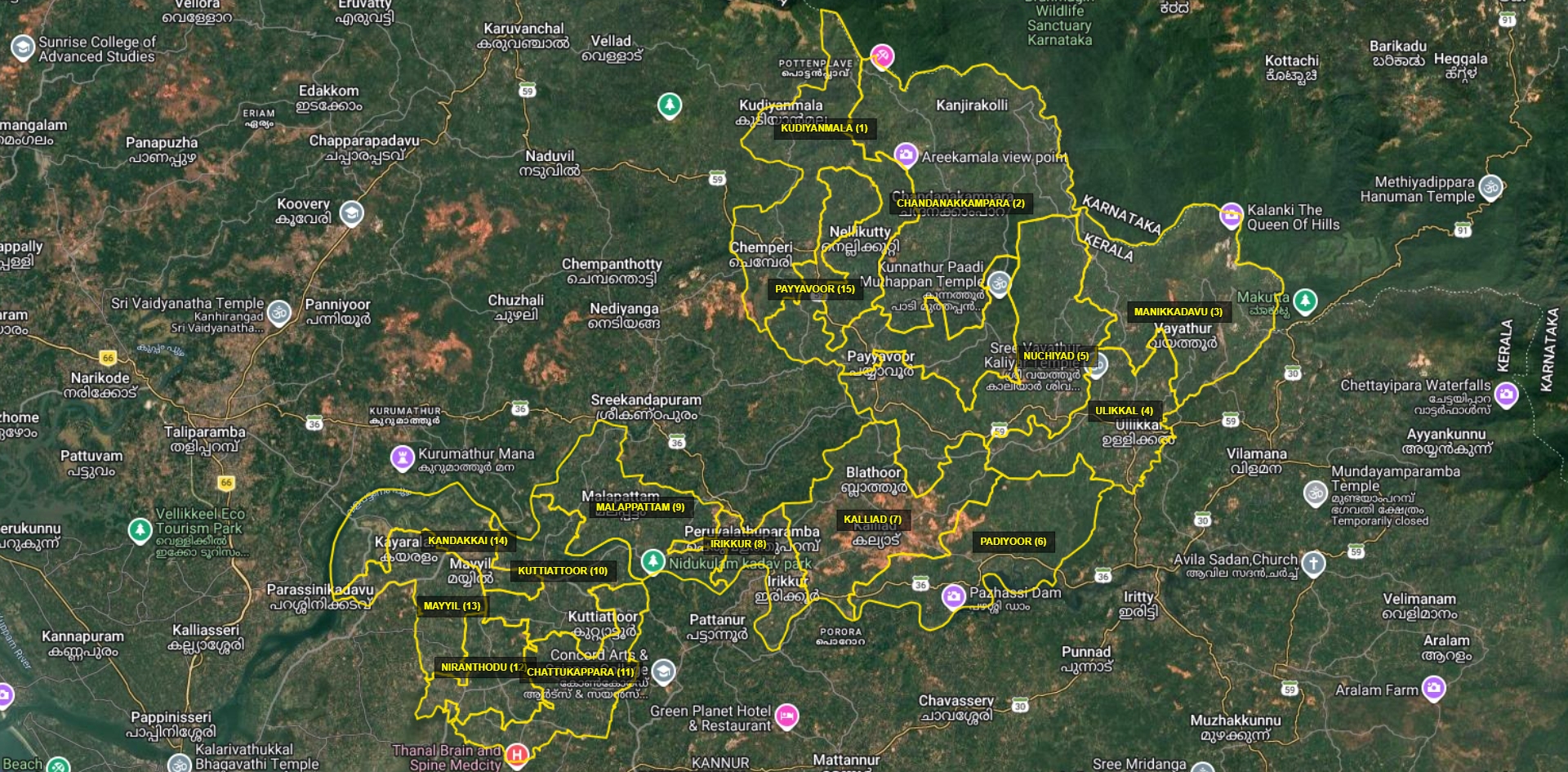
Irikkur Block Panchayat is a beautiful region situated close to the hilly areas of Kannur district in Kerala. Its geographical features are detailed below:
1. Boundaries and Location
Irikkur Block Panchayat is located in the eastern region of Kannur district. Its area spans across Taliparamba and Iritty taluks.
North:Payyannur and Taliparamba Blocks
East: Iritty Block and Karnataka forest area (near the Coorg mountain ranges)
South: Edakkad and Kuthuparamba Blocks
West: Kannur and Taliparamba Blocks
2. Topography
Based on its topography, the Irikkur block can be broadly divided into Highland and Midland regions.
• A major portion of this area is characterized by hills, small mountains, and slopes.
• It features fertile valleys and hilly slopes where crops like rubber, cashew, black pepper, and coconut thrive.
• The soil composition consists of laterite soil along with black soil in the hilly zones.
3. Water Bodies and Rivers
The Valapattanam River (also known locally as the Irikkur River) plays the most prominent role in the geography of the Irikkur Block.
• Originating from Coorg in Karnataka, this river provides ample water resources to the Irikkur region.
• Local residents rely heavily on the Valapattanam River and its tributaries for agricultural needs and drinking water.
4. Climate
The region experiences Kerala's typical tropical climate.
Rainfall:• The region receives abundant rainfall from both the Southwest Monsoon (Edavappathi) and the Northeast Monsoon (Thulavarsham). Due to its proximity to the hills, heavy rainfall occurs during the months from June to August.
Temperature:• Although it gets hot during the peak summer months (March to May), the presence of cool breezes from the hills helps lower the atmospheric temperature during the night.
5. Grama Panchayats Under Its Jurisdiction
The Irikkur Block Panchayat comprises the following Grama Panchayats:
• Irikkur
• Padiyoor-Kalliad
• Mayyil
• Malappattam
• Payyavoor
• Ulikkal
• Eruvessi
• Kuttiattoor
Irikkur Block Panchayat embodies the distinctive highland-midland topography of Kannur, characterized by rich water resources, rolling hills, and agriculturally viable soil.